Hidden Landscapes, Unseen Risks: Mapping Karst Vulnerability in Tasmania
Developing a Karst Vulnerability Index to assess land use pressures and potential water quality risk in Tasmania
Maggie Li and Rachel Roberts for University of Tasmania Unit KGG375
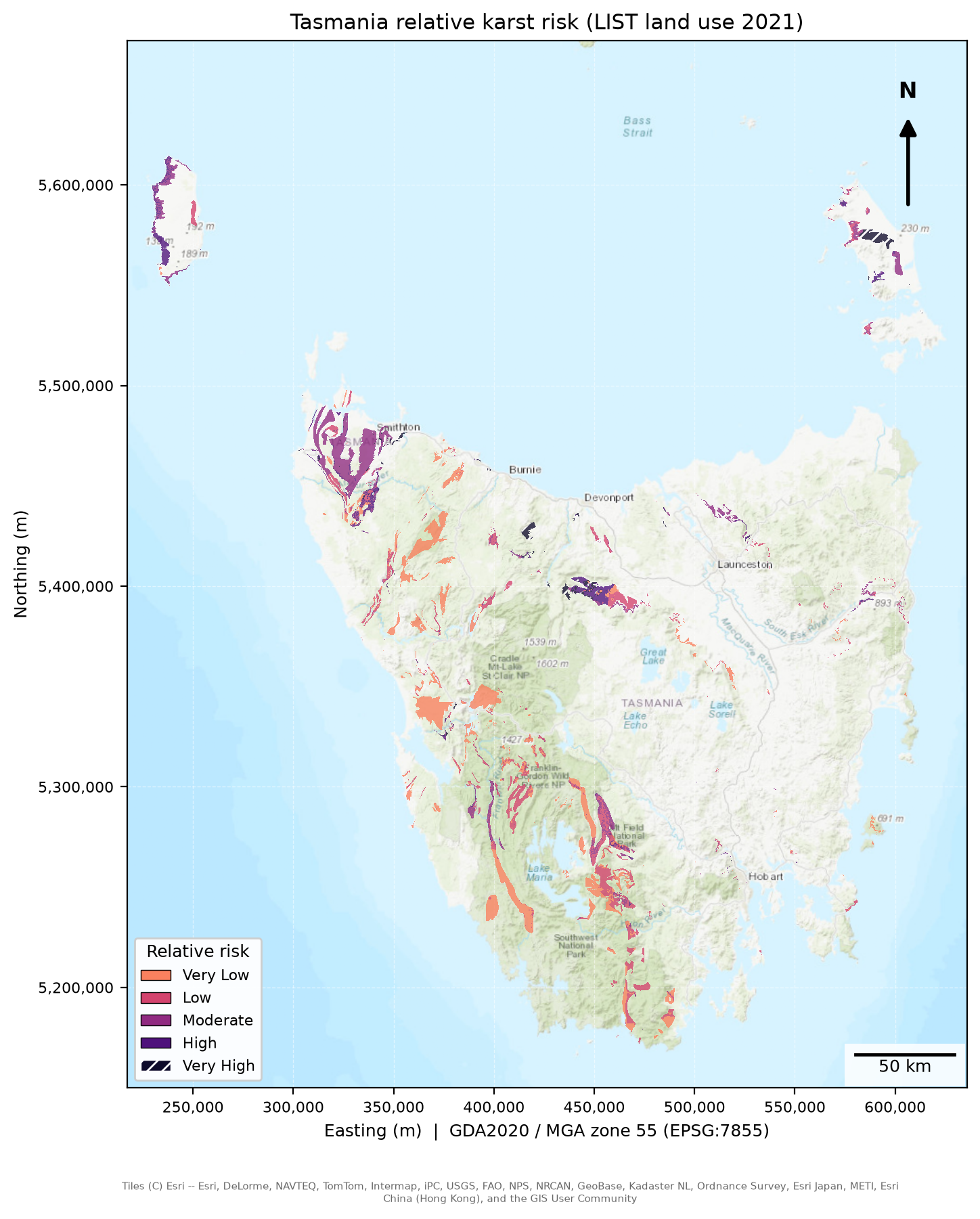
Relative karst risk across Tasmania, using LIST land use for 2021. Grey land has no karst mapped, which is not the same as low risk. The interactive map is on the Results page.
Use the navigation menu to explore the project background, methods, results, discussion, and conclusions.